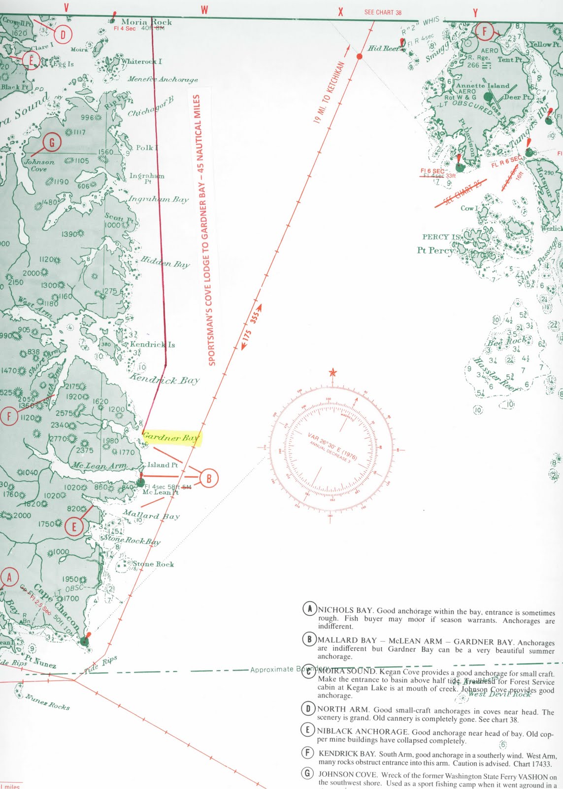
 This is a chart of the southeastern tip of Prince of Wales Island, Alaska. Cape Chacon (pronounce shack-un) is the point of land at the bottom left of the illustration. The entrance to Gardner Bay is highlighted in yellow. As you can see Gardner Bay is not very big.
We don't do Cape Chacon trips very often. It is a four hour run from the Lodge so the crews take the boats down the night before and the guests fly down to join us next morning, and fly back in the afternoon. This maximizes fishing time at the Cape. Obviously it is very expensive to charter floatplanes, so there is an additional cost for the trip. It is also very weather-dependent. This is the exposed open ocean, not like our protected Inside Passage waters back at the Lodge. We don't go unless there is an absolute guarantee of good weather, both for flying and fishing. So, when we do go, it is a spectacular trip.
The fishing isn't necessarily any better at the Cape. I have often come back from a Cape Chacon trip to learn that the boats fishing close to home out of the Lodge did far better than I. But the fishing and the environment is different. It's a wild and wooly place, above the surface of the ocean as well as below, as Jon Bender describes, and it has a charismatic attraction, a siren call, all of it's own.
It is 45 nautical miles from the Lodge to Gardner Bay and another 10 nautical miles to the Cape. The Canada/U.S. border runs only a short distance south of the Cape and is still in dispute to this day. You can click on the chart to enlarge it.
Captain Mac

Nice Captain, very nice Alaska Fishing Lodge
ReplyDelete